Star maps / Are star maps accurate?
Are star maps accurate? We checked ours against the real sky
For the stars, yes. On every night we checked from 1965 to 2034, each star on our poster sits within half a degree of where an independent astronomy library puts it, less than the width of the Moon.
Print from $39, framed from $89. Free US shipping.
Design your star mapThe poster in the editor is the file we print. You see it before you pay.

The short answer
- Where the stars are: within half a degree from 1965 to 2034We placed every star the poster draws a second time with astronomy-engine, an open source library by Don Cross that is tested against NASA JPL data, and measured the gap. For a 1969 night it is 0.36 degrees, about 0.7 mm on the print. For 1900 and 2100, the first and last years the editor takes, it grows to 1.2 degrees.
- Which stars: 4,086 from the Yale Bright Star CatalogEvery star down to magnitude 5.8, about the faintest the eye picks out under a dark country sky. Bright stars are drawn larger. The lines are the usual stick figures of all 88 constellations.
- What time: about 9 pm local sun timeOn US clocks that is between 8:44 and 10:44 pm in the 11 cities we checked, later in summer. No time is printed and you cannot choose another hour.
- What is not drawn: the Moon, the planets, the Milky WayThe poster shows stars and constellation lines only. Our free sky tool lists the Moon and the planets for any date.
How the sky on the poster is worked out
- 1. The placeYou type an address, a venue or a park and pick it from the list. We take its latitude and longitude. The same point gets the heart on the small street map.
- 2. The moment9 in the evening by the sun at that longitude on the date you type. We work it out from the longitude alone, so it does not depend on time zone or daylight saving rules of that year.
- 3. The starsEach star's position comes from the catalog as it stood in the year 2000. For your moment and place we turn the sky to the right angle and work out how high each star stood and in which direction.
- 4. The drawingThe half of the sky above the horizon is laid flat as seen looking up, with the point straight overhead in the middle, north at the top and east on the left. That is why east and west look swapped compared with a street map.
- 5. The printThe editor in your browser and our print server run the same code on the same star file. The preview is the print.
We checked it against an independent calculation
For six nights from 1900 to 2100 we let the poster code place every star it draws, then placed the same stars with astronomy-engine for the same minute and spot. Astronomy-engine also applies precession, nutation and aberration, the small corrections planetarium software makes. The gap is the distance on the sky between the two positions of each star.
| Night | Stars drawn | Typical gap | Largest gap | 18 × 24 in print |
|---|---|---|---|---|
| Jan 1, 1900, Times Square | 1,584 | 1.20° | 1.40° | up to 4.0 mm |
| Aug 14, 1945, Times Square | 1,541 | 0.65° | 0.76° | up to 2.1 mm |
| Jul 20, 1969, Houston | 1,529 | 0.36° | 0.43° | up to 1.2 mm |
| Dec 31, 1999, Times Square | 1,588 | 0.00° | 0.01° | 0.0 mm |
| Dec 24, 2026, Times Square | 1,582 | 0.33° | 0.38° | up to 1.1 mm |
| Dec 31, 2100, Times Square | 1,587 | 1.22° | 1.42° | up to 4.0 mm |
"Our star" design, every star of magnitude 5.6 or brighter above the horizon at the poster's 9 pm. Typical = median. Millimetres measured on the 18 × 24 in print, where the sky circle is 12.8 in across. The Moon is about half a degree wide.
Why the gap grows away from 2000: Earth's axis wobbles slowly, like a spinning top, once in about 26,000 years. The poster keeps the catalog positions of the year 2000, so it leaves out about 0.3 degrees for every 25 years before or after. The whole sky shifts together, so every figure keeps its shape.
Half a degree or less: every star, at 9 US cities, Anchorage and Sydney, on the 15th of January, April, July and October of each year from 1965 to 2034.
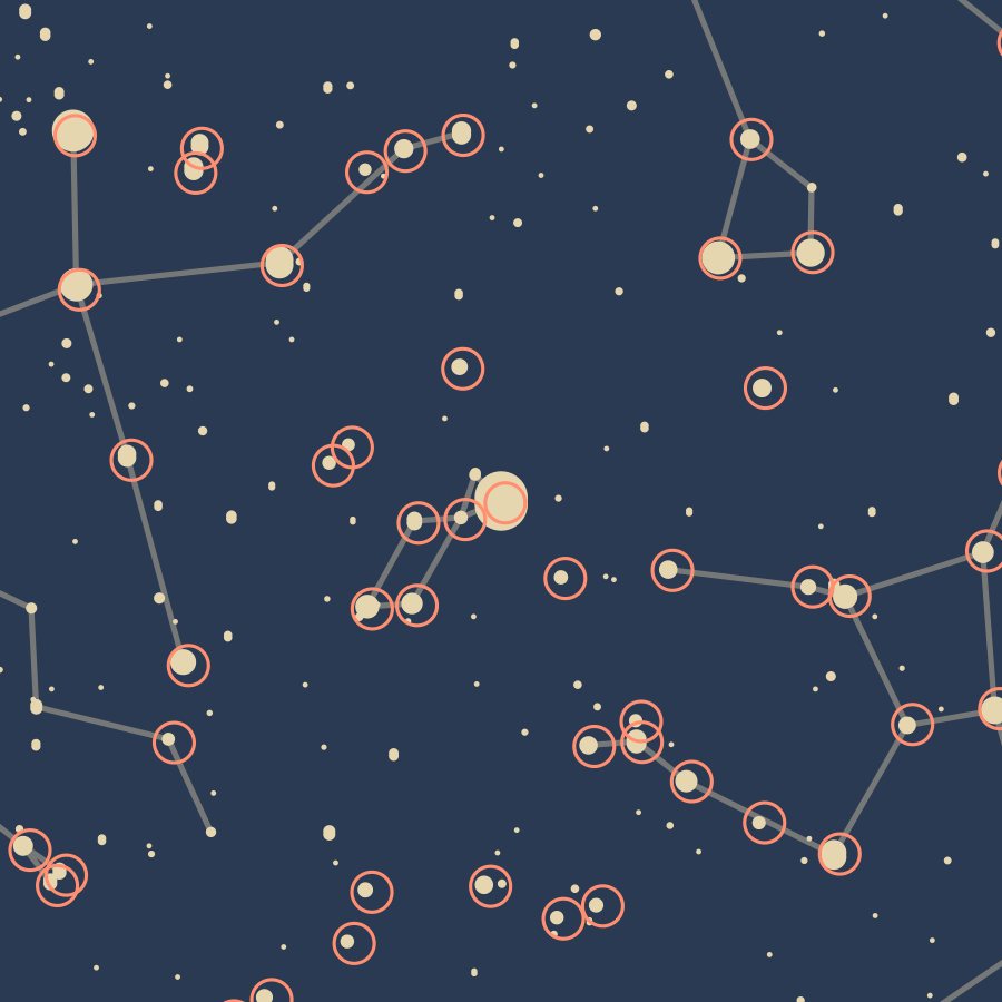
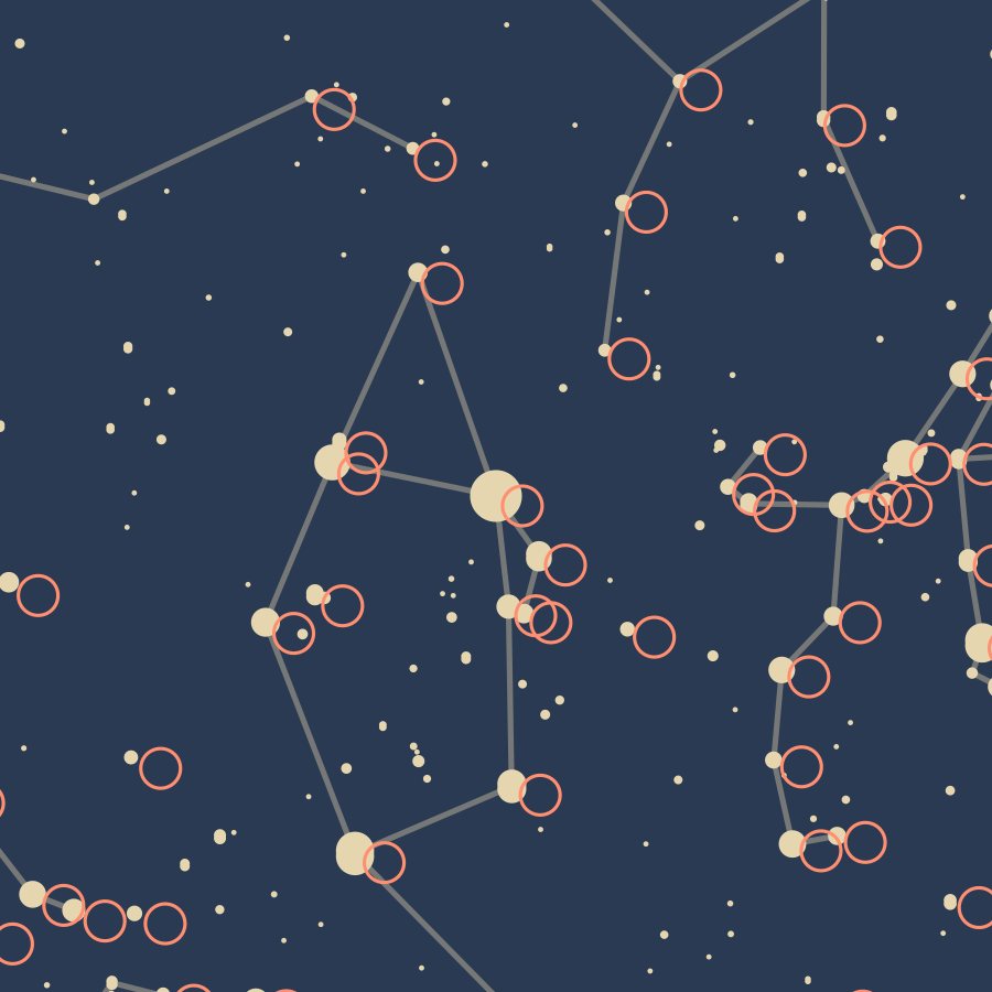
Each square is about 2.6 in of the 18 × 24 in print, shown much larger than it prints. The air near the horizon lifts stars by about half a degree. Like most star charts, the poster and this check leave that out.
The night of the first Moon walk, as the poster draws it
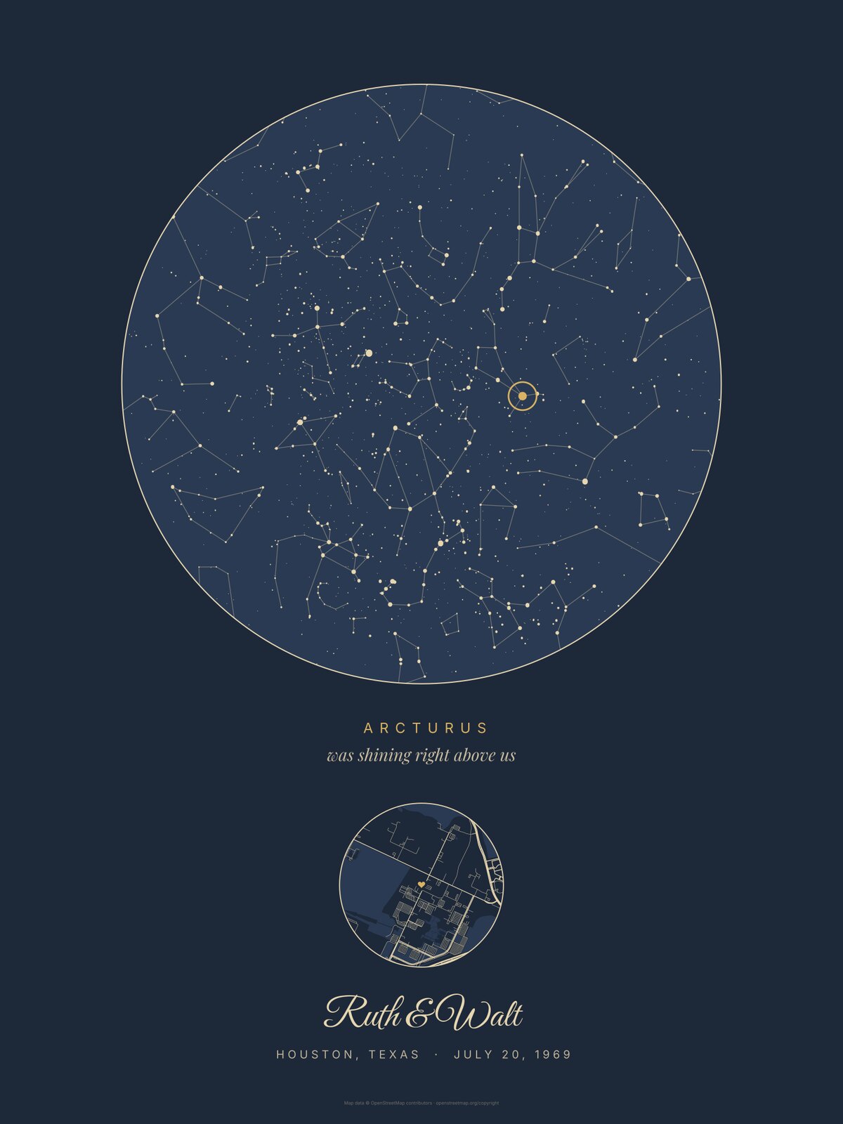
Our example poster is the sky over the Johnson Space Center in Houston (then the Manned Spacecraft Center) on July 20, 1969, for a couple we made up, Ruth and Walt, who married that day. The poster's 9 pm local sun time was 10:20 pm on Houston clocks, 24 minutes after the first step on the Moon at 9:56 pm. In those 24 minutes the sky turned about 6 degrees.
- The circled star: ArcturusThe brightest named star at least 45 degrees up, here 52 degrees up in the west. The "Our star" design always circles that star and prints its name.
- Also upVega 67 degrees up in the northeast, Altair 44 in the east, Antares 34 in the south, Spica 25 in the southwest.
- Not drawnThe Moon was up too, a waxing crescent, 36 percent lit, 18 degrees up in the west. See that night in our sky tool.
What time the poster shows
The poster is drawn for 9 pm by the sun, worked out from the longitude. Clocks run on time zones, so the same sky lands on a different clock time in each city, and an hour later when daylight saving time is on:
| City | January | July |
|---|---|---|
| Boston | 8:44 pm | 9:44 pm |
| New York | 8:56 pm | 9:56 pm |
| Atlanta | 9:37 pm | 10:37 pm |
| Detroit | 9:32 pm | 10:32 pm |
| Indianapolis | 9:44 pm | 10:44 pm |
| Chicago | 8:50 pm | 9:50 pm |
| Houston | 9:21 pm | 10:21 pm |
| Denver | 8:59 pm | 9:59 pm |
| Phoenix | 9:28 pm | 9:28 pm |
| Los Angeles | 8:52 pm | 9:52 pm |
| Seattle | 9:09 pm | 10:09 pm |
Clock time of the poster's sky on January 15 and July 15, 2026, with each city's time zone rules. Phoenix has no daylight saving time.
- An evening momentAnything from sunset to about midnight is close. The sky turns about 15 degrees an hour. On 73 percent of nights the circled star is still the same one an hour later, on 55 percent two hours later (nine US cities, every night of 2025).
- After midnightType the date the evening started. 1 am is four hours from the poster's 9 pm that evening and twenty hours from the next one.
- A daytime momentThe stars were there but hidden by daylight. The poster shows the ones that came out over that spot that evening.
What each design shows of the sky
All three designs draw the same stars in the same places. They differ in how much of the sky fits on the paper. Numbers for the Houston night above:
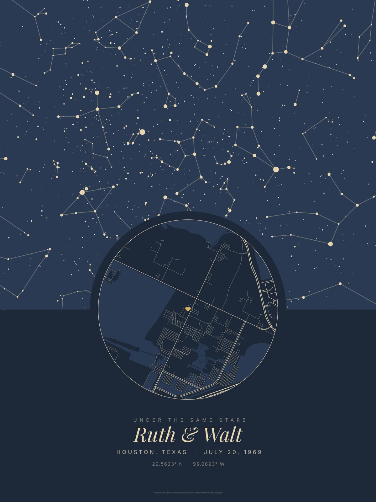
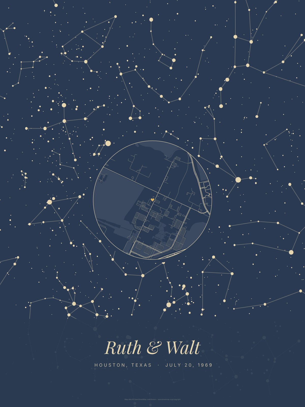
| Design | Share of the sky | Down to | Stars drawn |
|---|---|---|---|
| Our star | 100% | the horizon all around | 1,529 |
| Under the stars | 60% | 18 to 28° up east, west and north; the street map covers the south below 67° | 1,086 |
| The whole night | 53% | 23 to 30° up; the street map covers the point overhead | 1,022 |
Share of the sky above the horizon that is visible on the poster, not under the street map or the names. "Our star" draws stars to magnitude 5.6, the other two to 5.8.
- The star we nameOnly on "Our star": the brightest named star that stands 45 degrees or higher. If none is that high, the bar drops to 35, 25, 15 and 5 degrees, so a star is always named. On those nights the line under it reads "was shining above us" without "right".
- City lightsThe poster draws the sky as a dark site shows it. From a city street you see far fewer stars on that night.
Check your own night
- In our sky toolType the place and date in the sky on any date tool. It draws the chart with the poster's code and adds the Moon phase, the planets, sunset and full dark.
- In a planetarium programStellarium, free for computer and phone, shows the sky for any place and time. Set the spot, the date and the clock time from the table above (or about 9 pm by the sun for your town), turn off the atmosphere and compare the bright stars.
- Why another shop's map of the same night can look differentSome draw 10 pm or midnight. Others draw fewer stars, or use another projection or crop. A different hour moves every star by about 15 degrees.
Sizes and prices
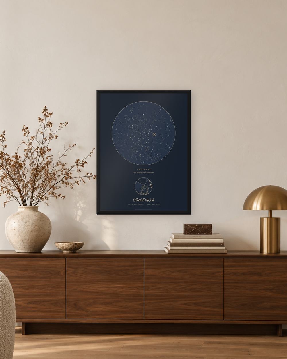
Each size and frame carries the same poster. The 12 × 16 in sits on a desk, the 18 × 24 in above a dresser or in a hallway, the 24 × 32 in over a sofa.
| Frame | 12 × 16 in | 18 × 24 in | 24 × 32 in |
|---|---|---|---|
| Print only | $39 | $49 | $69 |
| Black | $89 | $119 | $159 |
| White | $89 | $119 | $159 |
| Oak | $89 | $119 | $159 |
| Espresso | $99 | $129 | $169 |
| Black and gold | $139 | $179 | $259 |
Shipping is free in the US. Launch prices until Nov 30. More frames, and the price of every size and frame, are in the editor before you pay.
Returns
A poster with a name that arrived as ordered is not taken back. Damaged or printed wrong: email a photo within 30 days of delivery and we reprint or refund in full. See returns.
Questions
Is a star map from the 1950s or 1960s still accurate?
Yes. For a night in 1955 every star sits within 0.7 degrees of its true place, and from 1965 on within half a degree. The figures keep their shape, because the whole sky shifts together.
Can I choose the time on the poster?
No. The hour is the same for every order, about 9 pm by the sun on the date you type. For a moment past midnight, use the previous day's date.
Does it work for the southern hemisphere?
Yes. The same code draws the sky for any latitude, with the southern stars and the Southern Cross when they are up. We print and ship from the US.
Are the Moon and the planets on it?
No. The poster draws the stars and the constellation lines. Our free sky tool gives the Moon phase and the planets for your night.
Why does the sky look mirrored?
It is drawn as you see it lying on your back, head to the north. East is then on your left, the opposite of a street map seen from above.
Which star catalog do you use?
The Yale Bright Star Catalog, through the d3-celestial star files, every star down to magnitude 5.8.